|
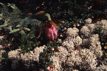
This page contains summary information about some of our completed ecosystem-based conservation planning projects. Follow the links (the underlined titles) to read project summaries complete with colour maps. You can also download the full project reports.
Creston Community Forest Initial Ecosystem-based Plan, May 2003 Summary
The town of Creston is located in the Kootenay region of southeastern British Columbia, near the United States border. The Creston community forest was created in 1997 and includes the 8,500 hectare Arrow Creek watershed that provides water for the town of Creston, the many orchards in the area, and for the Columbia Brewing Company, producers of Kokanee beer. The watershed is also an important recreation area and provides significant ungulate winter range.
The Creston Community Forest is governed by a corporation (Creston Valley Forest Corporation) made up of equal shareholders representing the town of Creston, the Regional District of Central Kootenay, the Creston Area Economic Development Corporation, the Lower Kootenay Indian Band, and Wildsight.
The community forest has been carrying out ecosystem-based timber management for several years, but did not have an ecosystem-based landscape plan to guide their operations into the future. Working with Jim Smith, the forester for the community forest, the Silva Forest Foundation prepared initial ecosystem-based mapping that defines a Protected Landscape Network composed of biodiversity nodes and ecological reserves, as well as areas that are potentially available for timber management.
Fraser Headwaters Proposed Conservation Plan, 2001 Summary
Working with the Fraser Headwaters Alliance, a non-profit grassroots conservation organization based in the Robson Valley, the Silva Forest Foundation prepared landscape-level ecosystem-based mapping for 1.3 million hectares (13,000 square km) in east-central British Columbia close to the BC-Alberta border. The study area runs approximately parallel to the Rocky Mountain Trench, stretching from Valemount in the southeast to Sinclair Mills in the northwest, and from the height of land in the Rocky Mountains down across the Rocky Mountain trench and up to the height of land in the Columbia Mountains.
The Fraser Headwaters Alliance continues to work towards protecting portions of the Robson Valley, particularly the upper reaches of the Goat River watershed where conventional logging has now begun, and towards ecologically responsible forest use in areas which do not require full protection.
Horsey Creek, 1999 Summary
The Silva Forest Foundation produced this plan for the Dunster Community Association and the Fraser Headwaters Alliance. The goal of the analysis, and the purpose of the report and the accompanying maps, is to provide practical information to local residents and groups who wish to protect, maintain, and plan for the ecologically sustainable use of the forests and waters that occupy this part of the Fraser River Headwaters. The plan is part of an ongoing project to develop and implement ecosystem-based mapping for the entire Robson Valley.
Harrop Procter Watersheds, 1999 Summary
This plan was completed for the Harrop-Procter Watershed Protection Society (HPWPS). The study area is the series of small watersheds on the south shore of the West Arm of Kootenay Lake in southeastern British Columbia, above the communities of Harrop and Procter. It runs from the west shore of Kootenay Lake in the east to the Harrop Creek drainage in the west, and includes all of the smaller watersheds along the north facing slope between.
Cortes Island, 1996 Summary
This report introduces the Cortes Island Ecosystem Based Plan prepared by the Silva Forest Foundation for the Cortes Island Forestry Committee. Cortes Island is located off the Pacific coast of British Columbia. The Cortes Island Ecosystem Based Plan (CIP) is a work in progress. As the maps and report show, a great deal has been accomplished, with unprecedented input and assistance from the local community
Slocan Valley, 1995 Summary
This plan for the Slocan River watershed in southeastern British Columbia represents a fundamentally different approach to looking at, and planning human activities in ecosystems. This was the first ecosystem-based plan completed by SFF using Geographic Information Systems (GIS) technology, and forms the foundation upon which our methodology has been refined.
|